Stanislaus, Sierra, and Sequoia National Forest Maps from 3FIA
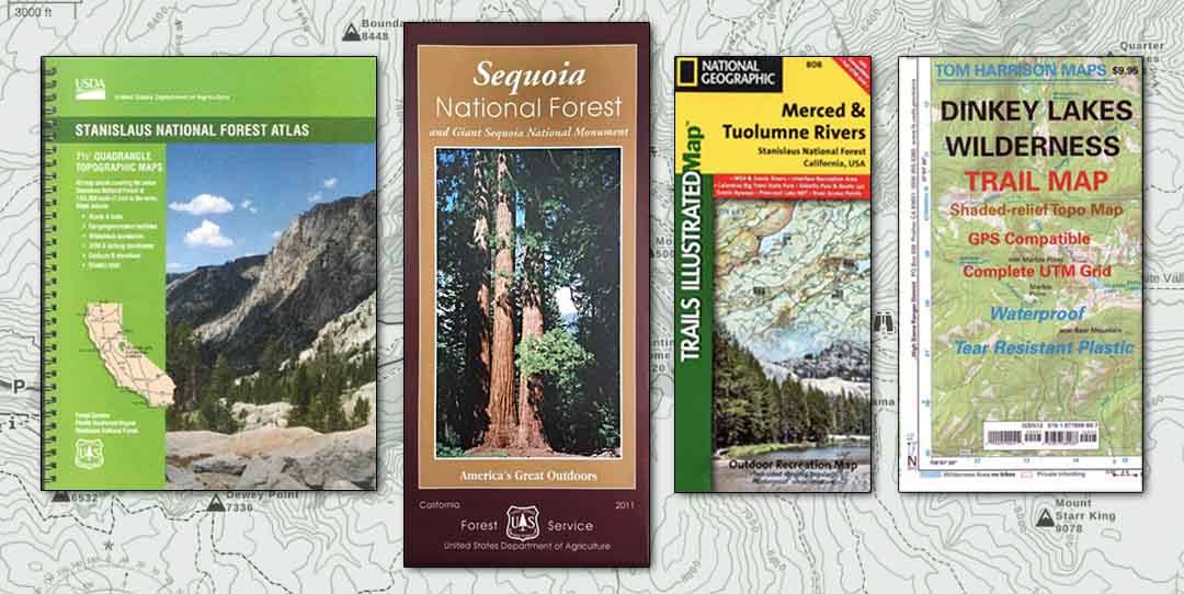
 Looking for printed maps to inform your next journey to the National Forests? Many traditional retail sources for these maps have been shuttered due to the pandemic. To keep these resources available to the public, 3FIA has now made printed maps for the Stanislaus, Sierra, and Sequoia National Forests available for sale online from our Shop Page. Choose from US Forests Service maps, the popular Tom Harrison Maps, and select maps from the National Geographic Trails Illustrated series. All prices include shipping.
Getting into the outdoors safely takes some planning. Printed maps now available for sale online include USFS Forest maps and atlases, as well as maps specific to the Dinkey Lakes, Carson-Iceberg, Mokelumne, Ansel Adams, and Golden Trout Wilderness Areas. Printed maps are still the best source for information while visiting the back country. Hikers, fisherman, backpackers, and all visitors to the forest can utilize these maps to enhance their experience of these public lands. Visit our Shop Page to view and order maps.
