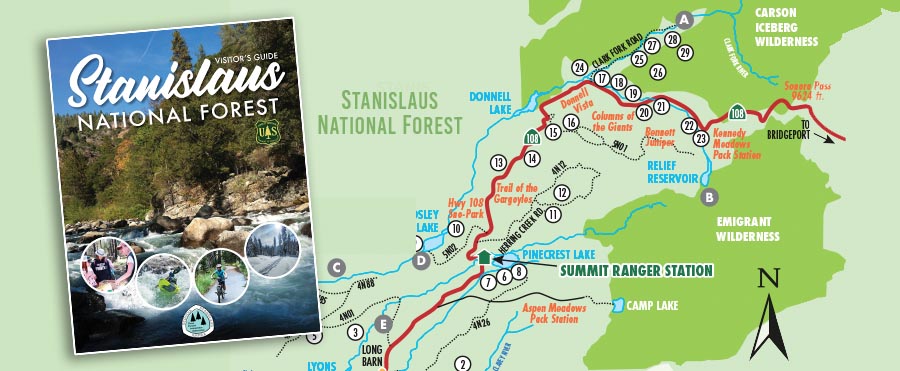
Visitors to the Stanislaus National Forest now have a new guide to locate and explore recreation resources. Three Forests Interpretive Association (3FIA) and the Stanislaus National Forest recognized a need for a printed magazine that could connect visitors to forest campgrounds, trailheads, and other recreation sites. There are many locations in the forest where cell phone signals are not available. These free printed guides get people where they want to be efficiently. Additionally the guides are a souvenir visitors can take home to plan their next trip – one that doesn’t get lost on their phone’s bookmark link list.
The guide focuses on each of the three highway corridors that visitors use to access the Stanislaus: State highway 4 in the north, highway 108 over Sonora Pass, and hwy 120 leading to Yosemite National Park. A detailed series of maps and charts include information on campground amenities and locations, hiking trailhead locations with levels of difficulty, and day use areas. Each corridor section features more detailed information on sites that are popular with forest visitors. The Guide also includes up-to-date information on volunteer programs, wilderness and campfire permits, Leave No Trace principles, and more. Click this link to download the online version of the Stanislaus National Forest Visitor Guide.
